 by
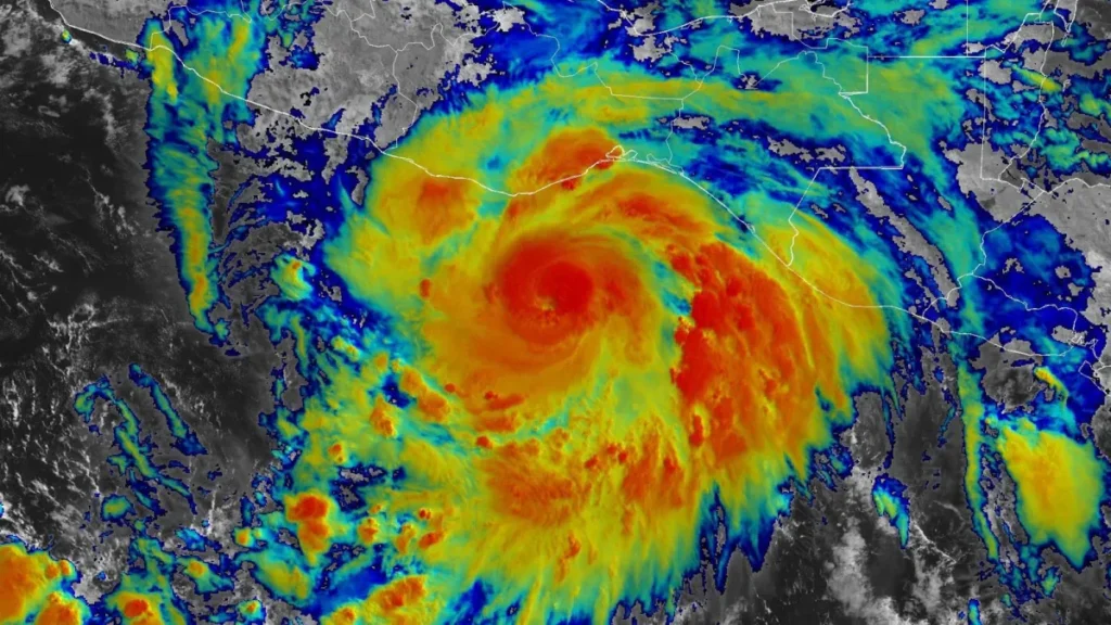
by MEXICO’S PACIFIC COAST, June 19, 2025 – Hurricane Erick has quickly strengthened into an extremely dangerous Category 4 cyclone and now threatens to slam Mexicos southern Pacific states with unprecedented force. As of Thursday afternoon, the storm is rushing toward Oaxaca and Guerrero, prompting forecasters to warn of deadly winds, torrential rain, life-threatening surge, and sweeping floods and mudslides.
Rapid Intensification and Dire Warnings Erick is the fifth named system and the first major hurricane of the 2025 Eastern Pacific season and surged from tropical storm to Category 4 in barely twenty-four hours. The U.S. National Hurricane Center (NHC) pegs its top sustained winds at 145 mph (230 km/h), placing coastal towns on extreme alert.
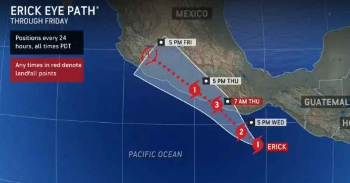
The storms forecast track has nudged south, bringing it nearer famed resorts such as Puerto Escondido in Oaxaca and the hard-hit city of Acapulco in Guerrero. Memories of Hurricane Otis, a catastrophic Category 5 that leveled Acapulco in October 2023, linger in residents minds and are spurring frantic preparations and widespread anxiety.
Anticipated Impacts and Affected Regions
Emergency officials are urging everyone in the storms path-residents and vacationers alike-to take safety steps without delay. The National Hurricane Center has placed the complete coastline between Acapulco and Puerto Angel under a hurricane warning.
Torrential Rainfall:
Oaxaca and Guerrero could receive as much as 16 inches (40 centimeters) of rain, with some sheltered valleys possibly exceeding 20 inches (51 centimeters). Such volumes create an extreme threat of flash flooding and mudslides on the regions steep slopes. Chiapas, Michoacn, Colima, and Jalisco will also see heavy rain.
Destructive Winds:
The storms eye will deliver winds strong enough to shatter trees and tear roofs from buildings where it comes ashore. Residents should brace their doors and windows, secure or store outdoor furniture, and move vehicles away from low canopies.
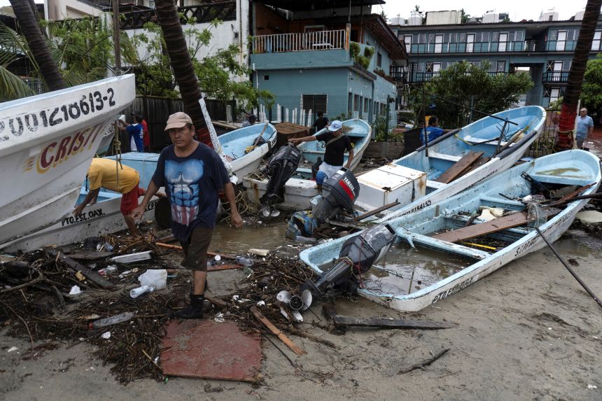
Storm Surge and Coastal Flooding: A life-threatening surge is forecast, pushing seawater inland and stirring massive waves, especially in zones where the wind blows onshore before landfall.
Power Outages and Infrastructure Damage:
Widespread blackouts are likely, and roads, bridges, and communication lines-men already weakened by earlier storms-are at high risk of severe destruction.
Government and Community Response
Mexican President Claudia Sheinbaum has asked citizens to follow official updates, stay inside, and head to designated shelters if they live in low-lying neighborhoods or close to rivers. Officials have set up roughly 2,000 temporary shelters across Chiapas, Guerrero, and Oaxaca.
In Guerrero, Governor Evelyn Salgado shut schools for a second day and urged fishermen and tour operators to secure boats. Acapulco’s port was closed Tuesday evening, and National Guard troops and police are patrolling to assist and issue warnings.
Preparation is Key: What to Do Now
Residents in or near the danger zone should act without delay:
Secure Your Home: Cover windows, reinforce doors, and move indoors anything that could be hurled by wind.
Gather Essentials: Pack a disaster kit with at least three days of water (3 liters per person per day), canned food, medicines, batteries, flashlights, and sanitary items.
Charge Devices: Plug in phones, power banks, and other vital electronics until they are full.
Know Your Evacuation Zone: Map local escape routes and shelters now so you can leave quickly if ordered.
Stay Informed: Continually track advisories from the National Hurricane Center, local emergency offices, and trusted news outlets.
Check on Neighbors: Reach out to older residents or individuals with disabilities who may need support gathering supplies or leaving home.
Hurricane Erick 2025 illustrates how quickly and forcefully a tropical storm can change lives. As the system nears shore, priority shifts to safeguarding people and limiting damage along Mexicos Pacific coastline. Stay safe, remain alert, and follow every official directive.